
Topography
High-Precision Aerial Topographic Surveys
The most innovative and reliable solution for obtaining accurate, detailed, and up-to-date geospatial data in a short time. Dronemaster uses professional drones equipped with next-generation sensors and advanced photogrammetry software to provide aerial topography services ideal for construction, infrastructure, precision agriculture, urban planning, quarries, and environmental monitoring.
Our Solution
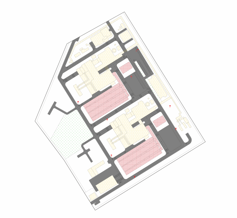
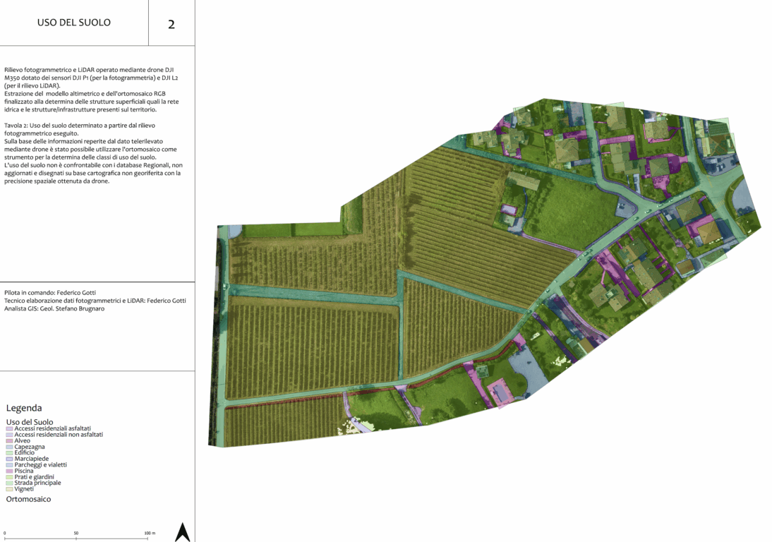
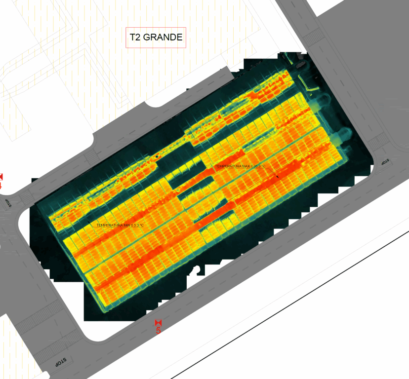
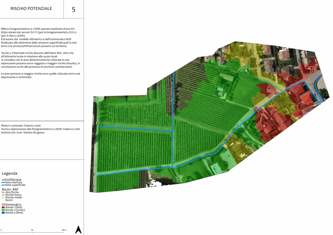
Thanks to our ENAC-certified drones (authorizations no. 3975 and no. 4488) and highly qualified operators, we perform topographic surveys that deliver high-resolution orthophotos, 3D models of terrain and structures (DSM and DTM), georeferenced point clouds, cross-sections and elevation profiles, volume and surface calculations, cadastral mapping and cartography updates, as well as site monitoring and progress tracking.
Advantages of Drone Topography
- Speed and cost savings: survey large areas in just a few hours, reducing time and costs compared to traditional methods.
- High accuracy: georeferenced data and reliable results thanks to GNSS RTK/PPK and professional software.
- Safety: no need to access hazardous or hard-to-reach areas.
- Versatility: suitable for construction, infrastructure, agriculture, quarries, landfills, industrial, and environmental areas.
Fields of Application
Dronemaster’s aerial topography services are ideal for design and management of construction and road sites, monitoring and management of infrastructure (bridges, viaducts, dams), precision agriculture and farm management, mapping of quarries, landfills, and industrial areas, cadastral updates and surveys for urban planning, environmental monitoring, and landslide prevention.
Why Choose Dronemaster for Aerial Topographic Surveys?
Choosing Dronemaster means selecting a reliable partner with experience, cutting-edge technology, and full regulatory compliance. We offer personalized consulting, detailed reports, and constant support at every project stage, from planning to delivery of final data.
Contact us for a free consultation or to request a personalized quote for drone topography services.
Ask for
information
Grants and Public Funding
Granting Authority: Italian State
Amount Awarded: €16,398
Purpose: Investment Bonus under Law 160/2019
Certifications and Regulatory Compliance
