
Photogrammetry
Photogrammetry, Topography, and GIS with Drones
Rely on Dronemaster for high-precision aerial photogrammetry and terrestrial scanning services. We use professional drones and advanced technologies such as the DJI MATRICE 400 RTK and next-generation sensors to acquire detailed topographic data, create 3D models, orthophotos, and digital maps—ideal for construction, engineering, agriculture, and land management.
What is Drone Photogrammetry?
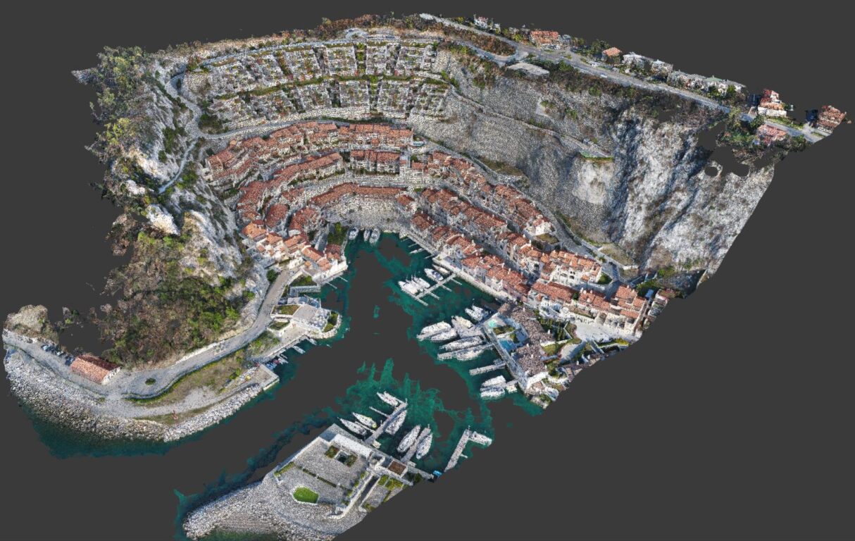
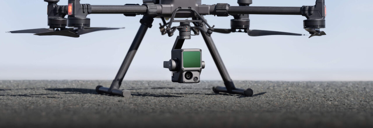
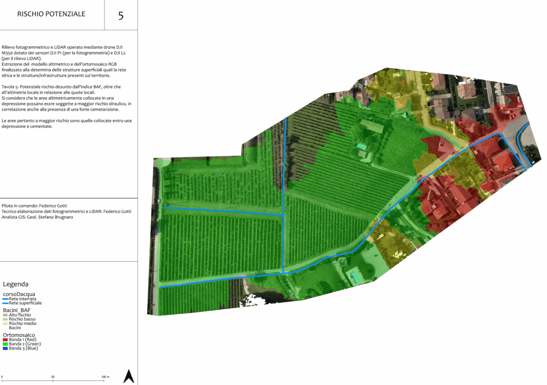
Drone photogrammetry is a survey technique that allows the acquisition of metric data from any object through the capture and analysis of stereometric image pairs. With aerial photogrammetry, it is possible to identify the spatial position of points of interest and reconstruct highly accurate 3D models. Using our MATRICE 300 RTK drone, we perform precision photogrammetry leveraging direct RTK and PPK centimeter-level georeferencing, the most advanced technologies available today.
The Advantages of Direct Georeferencing
- Time savings in the field: fewer personnel and less expensive equipment required
- Greater safety for mapping in hazardous or inaccessible locations
- Eliminates costs for securing the operational area
- Reduces the risk of workplace accidents
- No plant shutdowns
- Provides otherwise inaccessible points of view
- Enables real-time analysis
- Speeds up and streamlines operations
- Significantly increases the quantity and quality of available information
- Allows faithful 3D reconstruction
Our Technologies
Thanks to the use of Zenmuse L1-L2 and Emesent Hovermap technology, we can provide real-time 3D data throughout the day, efficiently capturing the details of complex structures and delivering highly accurate reconstructed models. The integration of aerial surveys and terrestrial scanning enables a comprehensive, accurate, and up-to-date view of any area or structure, even in complex environments or dense vegetation.
Our Solution
- Acquisition of georeferenced data from drones and terrestrial scanners
- Processing of integrated 3D models
- High-resolution orthophotos
- Technical support and personalized consulting
Contact us for a free quote and discover how drone photogrammetry and terrestrial scanning can optimize your projects!
Ask for
information
Grants and Public Funding
Pursuant to Article 1, paragraph 125 of Law 124/2017, below is a summary of the public funding received in the fiscal year 2022:
- Granting Authority: Italian State
- Amount Awarded: €16,398
- Purpose: Investment Bonus under Law 160/2019
Certifications and Regulatory Compliance
As a certified Operator/Pilot holding ENAC authorizations no. 3975 and no. 4488, all our operations are conducted in full compliance with the Regulation on Remotely Piloted Aircraft Systems (RPAS), with specific reference to Article 8. Our commitment to regulatory adherence ensures that every service provided meets the highest standards of safety, legality, and operational excellence as required by national and international aviation authorities.
Our certifications